You can sponsor this page

Brevoortia patronus Goode, 1878

Gulf menhaden
Add your observation in Fish Watcher
Native range | All suitable habitat | Point map | Year 2050
This map was computer-generated and has not yet been reviewed.
Brevoortia patronus   AquaMaps   Data sources: GBIF OBIS
Upload your photos and videos
Pictures | Google image
Image of Brevoortia patronus (Gulf menhaden)
Brevoortia patronus
Picture by McDonald, D.L.


United States (contiguous states) country information

Common names: Gulf menhaden, Largescale menhaden, Menhaden
Occurrence: native
Salinity: brackish
Abundance: | Ref:
Importance: highly commercial | Ref: FAO, 1994
Aquaculture: | Ref:
Regulations: | Ref:
Uses: no uses
Comments: While in inshore waters, age 1 and older Gulf menhaden are subject to an intensive purse seine fishery that extends from Florida to eastern Texas fron about mid-April to early October (Ref. 34923). The fish are processed into meal, oil, and solubles at plants in Mississippi and Louisiana (Ref. 34923).
National Checklist:
Country Information: https://www.cia.gov/library/publications/resources/the-world-factbook/geos/us.html
National Fisheries Authority: http://www.nmfs.gov
Occurrences: Occurrences Point map
Main Ref: Whitehead, P.J.P., 1985
National Database:

Common names from other countries

Classification / Names ชื่อสามัญ | ชื่อพ้อง | Catalog of Fishes(สกุล, ชนิด) | ITIS | CoL | WoRMS | Cloffa

> Clupeiformes (Herrings) > Alosidae (Shads and Sardines)
Etymology: Brevoortia: From James Carson Brevoort (1818-1887), studie the fauna from Ohio and South Caroline (Ref. 45335).
  More on author: Goode.

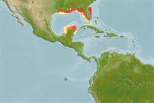
Environment: milieu / climate zone / depth range / distribution range นิเวศวิทยา

Can't connect to MySQL database (fbapp). Errorcode: Too many connections