You can sponsor this page

Calamopteryx goslinei Böhlke & Cohen, 1966

Longarm brotula
Add your observation in Fish Watcher
Native range | All suitable habitat | Point map | Year 2050
This map was computer-generated and has not yet been reviewed.
Calamopteryx goslinei   AquaMaps   Data sources: GBIF OBIS
Upload your photos and videos
Pictures | Google image
Image of Calamopteryx goslinei (Longarm brotula)
Calamopteryx goslinei
Picture by FAO


Bahamas country information

Common names: Longarm brotula
Occurrence: native
Salinity: marine
Abundance: | Ref:
Importance: | Ref:
Aquaculture: | Ref:
Regulations: | Ref:
Uses: no uses
Comments: Known from the Little Bahama, Great Bahama and Cay Sal Banks.
National Checklist:
Country Information: https://www.cia.gov/library/publications/resources/the-world-factbook/geos/bf.html
National Fisheries Authority: http://www.caricom-fisheries.com/bahamas-fisheries
Occurrences: Occurrences Point map
Main Ref: Böhlke, J.E. and C.C.G. Chaplin, 1993
National Database:

Common names from other countries

Classification / Names প্রচলিত নাম সমূহ | প্রতিনাম সমূহ | Catalog of Fishes(গণ , প্রজাতি ) | ITIS | CoL | WoRMS | Cloffa

> Ophidiiformes (Cusk eels) > Bythitidae (Livebearing brotulas)
Etymology: Calamopteryx: Greek,kalamos = a reed, a cane, 1712 + Greek, pteryx = fin (Ref. 45335).
  More on authors: Böhlke & Cohen.

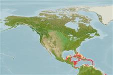
Environment: milieu / climate zone / depth range / distribution range বাস্তুসংস্থান

Can't connect to MySQL database (fbapp). Errorcode: Too many connections