| Ecosystem |
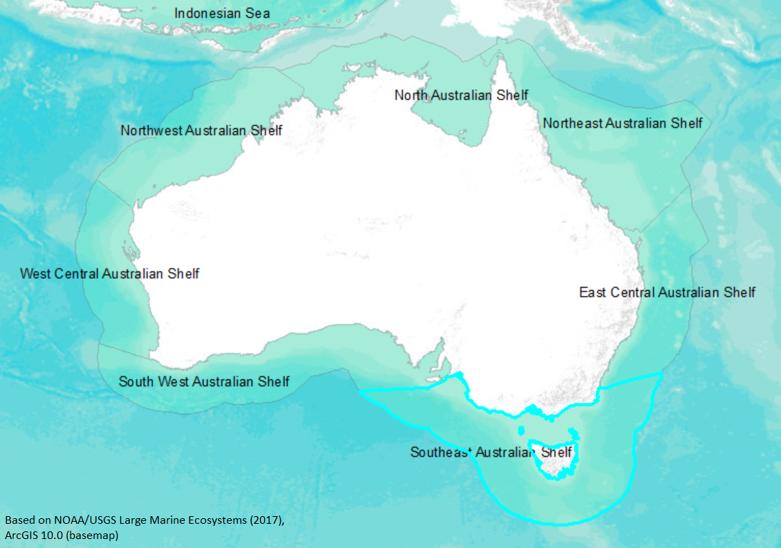
Southeast Australian Shelf |
| Type |
Sea/Bay/Gulf |
| Salinity |
saltwater |
| Other Names |
|
| Location |
|
LME SAU No 42. LME2002, LME2006, SAU 2008. |
32° S 50° S - 131° E 152° E |
|
| Location Map |
Southeast_Australian_Shelf.png |
| Size Ref |
|
River Length |
|
Area |
1193820 km2 |
Drainage Area |
|
|
| Depth |
|
Average Depth |
|
Max Depth |
|
Ref |
|
|
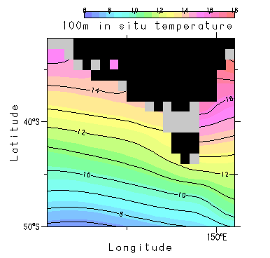
| Temperature |
|
| Description |
The Southeast Australia Large Marine Ecosystem extends from Cape Howe, at the southern end of the state of New South Wales, to the estuary of the Murray-Darling river system in the State of South Australia. It borders the Southern Ocean and the western boundary currents flowing into the West Wind Drift, which circulates around the continent of Antarctica. It contains the island of Tasmania and the Bass Strait, which separates the island from the Victoria State mainland in the Tasmanian Sea. The LME has a diversity of habitats such as seagrass beds, mud flats, intertidal and sub-tidal rocky reefs, mangrove kelp forests and pelagic systems. The Murray-Darling river system has a large catchment area, and it transports nutrients and sediments from the land into the coastal waters. The climate is temperate (http://na.nefsc.noaa.gov/lme/text/lme42.htm). |
| Comments on faunal list |
Area from SAU (November 2015). |
| URL 1 |
http://www.seaaroundus.org/lme/42.aspx |
| URL 2 |
|
| Ecosystem Checklist Link |
|
| Total |
|
Species |
Families |
Species |
Families |
Reference |
|
244 |
108 |
|
|
|
|